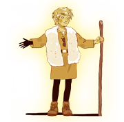
Welcome to my home! In the 13th century, I was a shepherd in this area and I went to all the local farm markets, then I started to preach in the churches ... So you could say I know my way around. Of course things have changed but there are still plenty of relics from my day. Anyway lets start with getting here...
The Guillestre area (or “Guillestrois” in French) is made up of 8 villages within the administrative boundaries of the “Communauté des Communes du Guillestrois”: Eygliers, Guillestre, Mont-Dauphin, Réotier, Risoul, Saint-Clément-sur-Durance, Saint Crispin and Vars.
The tops of the surrounding mountains reach 3 385 m and the Durance and Guil river valleys are at 858 m. Situated between the Parc régional du Queyras and the Parc national des Ecrins, the Guillestre area is full of stunning natural scenery to admire and explore, all bathed in glorious alpine sunshine for 300 days of the year.

By road
- From Italy or Briançon, via Saint Crépin
- From Gap, via Saint Clément-sur-Durance
- From Italy, Barcelonnette via Vars
- From Italy, Queyras, via Guillestre
Traffic info : Info route 05
By train
- Local trains stop at Eygliers, the station is called Montdauphin Guillestre.
- The Paris-Briançon night train.
- The closest high-speed TGV stations are Valence, Grenoble, Oulx in Italy (Resalp shuttle service) and Aix en Provence.
- Further information: SNCF and TER paca
Further information : SNCF and TER paca
By coach
- Local county coach services at lignes intradépartementales du CG 05"
- LER regional express service which appears in the CAR pictogram in the TER Brochures
- The SCAL private service from Aix-en-Provence or Marseille,
Nearest Airport
Marseille, Lyon, Grenoble and Turin (Italy)
Some distances
- Briançon : 26 km
- Gap : 52 km
- Turin : 138 km
- Grenoble : 150 km
- Marseille : 200 km
- Lyon : 250 km
- Paris : 700 km

